
May 8, 2026
Life-giving Beaches
As told to Erin Linn McMullan
ƛaʔuukʷiʔatḥ Tribal Parks are recognized worldwide for their life-giving beaches abundant with biodiversity and stewarded by nuučaan̓uł Peoples since time immemorial.
“Every beach is unique and cherished and irreplaceable,” says Gisele Martin, Tla-o-qui-aht Tribal Parks Guardian. “Though we haven’t counted the grains of sand on yaaqsis (pronounced yaaq-sis and also known as ‘Long Beach’) they’re not infinite, they’re finite.
“Each one has been created out of shells of different animals or sand from the last ice age or thousands of waves that have helped grind rocks down. Everything has taken a lot of time to create, and we want to protect these places for future generations into the far, far future, not just human generations but cedar tree generations – expanding thousands of years.
“The care,” she emphasizes, “has been in place for thousands of years and we’re inviting people to join us in helping continue that protection by taking the ʔiisaak Pledge.
Gisele generously shares her knowledge of local beaches from a nuučaan̓uł perspective which, as she remarks, is from the water – their ocean highway – and with names often reflecting their significance in the web of life.
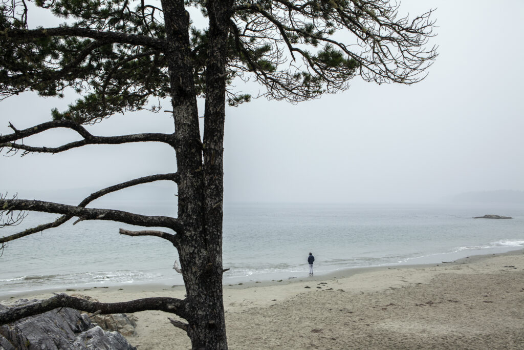
tinwis (pronounced tin-u-wis) meaning “calm waters”
This virtual tour begins with tinwis – home to Tla-o-qui-aht owned Tin Wis Resort, an Original Original and Authentic Indigenous – a beach whose name is now restored after briefly being known as MacKenzie Beach.
“tinwis is an important historical village site of Tla-o-qui-aht Nation,” emphasizes Gisele. “tinwis means calm waters or water calming. Names in our language are formed of verbs that are put together. It’s a very descriptive, verb-oriented language. It’s not use-centric,” she explains, “but describes them for how they are.
“tinwis is an important village site that was a summer village site and a place where we would anchor our whales, a little bit out of the current there behind the rocks after going whale hunting.
“When looking at the maps, we can see that south of tinwis, the shoreline becomes a lot more exposed into the open ocean. So, tinwis is the first beach where it’s often quite calm and it’s generally a safer place for little kids to swim and families to play in the water.

“tinwis is very important for the seagulls and many other animals and plants that belong there as well.” She recalls, “Last year UUQMIS and On the Land Learning Youth came together with Tla-o-qui-aht Tribal Parks and Tin Wis to create some restoration areas on the beach because the grass that our Elders need for weaving regalia has been getting really trampled and there aren’t very many beaches where it’s growing anymore. We roped off some areas, and it was starting to grow more last summer.”
As part of the Tin Wis 10 in 10 initiative, the resort’s ongoing commitment to Indigenous plant restoration this year includes: wetland sedgings and western Hemlock, sword and deer fern understory, and medicinal shrubs like salal and evergreen and red huckleberry.
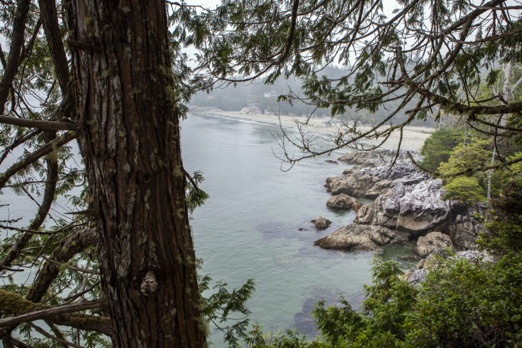
ḥiłwinʔis (pronounced hilth-win-is), aka “Middle Beach”
If you follow the high tide trail from tinwis, you’ll reach ḥiłwinʔis, which Gisele describes as “an important quiet beach”. “It’s also backed by some of the largest tracts of remaining old growth on the peninsula in Esowista Tribal Parks,” providing habitat for birds and animals. She reminds visitors that “there are bears and wolves and cougars on the peninsula. So, it’s important to be careful and be respectful of those animals who live there.”
From the sandspit that forms at low tide beneath a constellation of stars to the barnacle colony near the trailhead to ƛaakašiis, ḥiłwinʔis is also abundant with marine life.
ƛaakašiis (pronounced tlaa-ka-shiis) meaning the place where whales stand on the beach, aka Tonquin Beach Park
“ƛaakašiis means standing on the beach,” says Gisele, place names were among her first focus as she worked hard to relearn her language. “Indigenous languages have been severely threatened by Indian Residential Schools and various acts of the Canadian government.
“The day I learned the name ƛaakašiis we went canoeing in a traditional dugout canoe and paddled along the shore. Lo and behold, a whale stood up doing exactly what was described in the place name.
“The sand has a steep drop off and they sometimes rub their heads when they get itchy with all those whale lice and barnacles,” she explains, adding, “They sometimes spy hop, stand on their tails and just look around.”
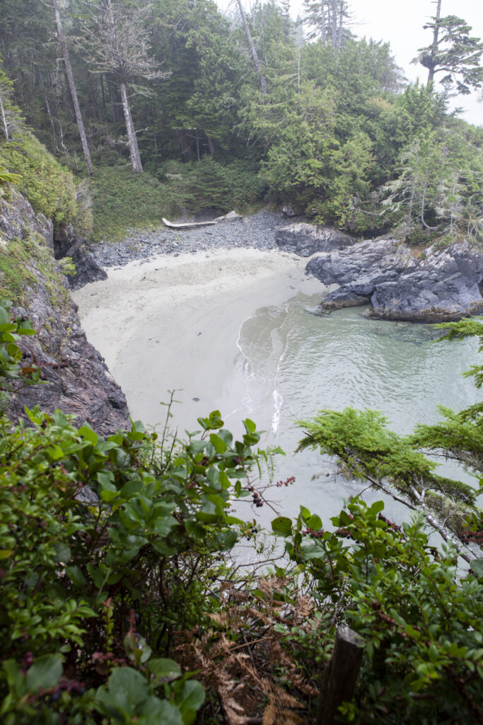
Asked about “Second” and “Third” Beaches, she emphasizes that it’s one continuous shoreline. “They’re all called ƛaakašiis and it’s because the Nuu-chah-nulth ocean-going canoe perspective is from the water, not the land.”
From tinwis, if you follow the MUP in the other direction you can easily walk or bike to n̓an̓aquuʔa and yuʔatu.
n̓an̓aquuʔa (pronounced nah-nah-kuu-ah) meaning Needlefish around the point, aka North Chesterman
“It’s a prime needlesfish spawning area, these tiny little fish that spawn November through mid-February. Their eggs are about the size of a grain of sand, and they spawn right in the life-giving beach sand. They’re an integral food for countless birds and salmon; they’re at the base of the food chain.
“My dad told me when he was a child that there was usually a really dark cloud over that beach. When returning from offshore fishing with my grandpa it looked like a really dark cloud in the distance. As they got closer, it became visibly made of birds.
“There were all kinds of sea ducks and seagulls there and then also a lot of sea life in general all eating those needlefish.”
This spawning ground encompasses both north and south beaches, “especially the sand bar connected to c̓ixwatsac, aka Frank Island.”
To protect this habitat, Gisele stresses how vital it is to remove all traces of dog waste. “Traditional knowledge informs that the smell of dogs can scare away needlefish from spawning,” explaining that she’s heard similar traditional knowledge shared all down the coast of North America.
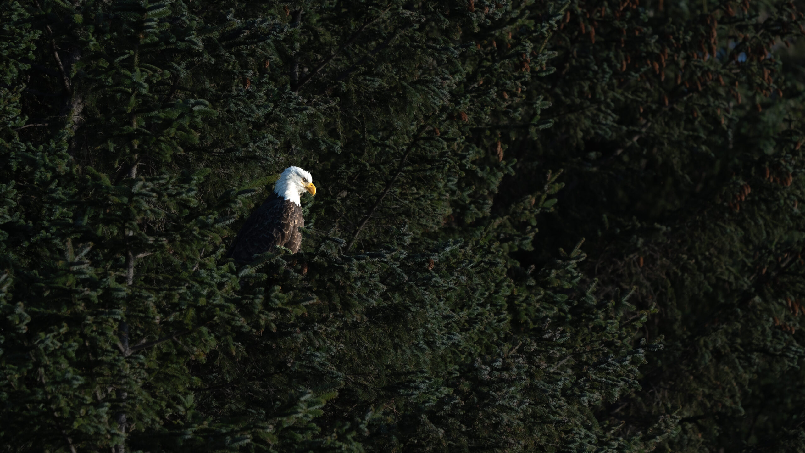
c̓ixwatsac (pronounced Tsix-wat-sats), meaning throne of the eagle (c̓ixwatin), aka “Frank Island”
“c̓ixwatsac means eagle nest place or place of the eagle or even throne of the eagle,” shares Gisele. “And the reason the eagles lived out there is to be close to the birds they hunt – they’re the number one predator of seagulls and sea ducks. And so, with all the needlefish nearby, they were eating those ducks that were eating the needlefish. It’s a prime spot for them to raise young.”
Describing the tombolo of sand joining n̓an̓aquuʔa and yuʔatu together at low tide, she says, “It’s a beautiful place to expand your perspective if you walk out to c̓ixwatsac and look back along that sandspit. You can see both sides of the beach, and you can see the mountains of wanačas hiłḥuuʔis Tla-o-qui-aht Tribal Park behind it. Expanding perspective is also a teaching in connection with eagles, who belong there.”
yuʔatu (pronounced yu-aht-u?) meaning winds on the beach or north wind blowing out towards the ocean, aka South Chesterman
“yuʔatu is also known as č ̓aḥayis,” Gisele explains. “Because again, if you’re thinking about place names from the water, and maneuvering by canoe out there, that entire shore is one bay.
“And so č ̓aḥayis is the name of that whole bay that includes South Chesterman and Cox Bay. But now it’s influenced by the English language it applies specifically to Cox Beach.”
ƛ̓uč̓ imnit, (pronounced tlu-chim-nit) aka Rosie Bay
Next to yuʔatu, ƛ̓uč̓ imnit is well known as an important surf break and usually only accessible as a beach during low summer tides once the sands replenish after winter storms.
č ̓aḥayis (pronounced Cha-ha-yis) meaning rough landing, aka “Cox Bay”
“It means rough landing or big waves on landing onto the beach,” says Gisele, of this popular coldwater surf spot. Surfing is being reclaimed as an Indigenous sport locally through the efforts of nuučaan̓uł youth organization mułaa: Rising Tide Surf Society.
From the land, she shares that “č ̓aḥayis is also a place where we harvest special cultural materials for making bentwood boxes.”
ƛ̓isnaak (pronounced tlis-naak) meaning has a meadow, aka “Cox Bay Lookout”
“That’s an important place with history and as a lookout as well,” says Gisele, adding that there is also an Indigenous medicinal plant garden there.
nac̓aas (pronounced nats-as), meaning lookout spot, aka “Radar Hill”
“From the top of nac̓aas is also a good place to look out over the water and all over the place,” says Gisele. “You’ll notice it begins with n.a., just like naciqs, the name for Tofino, and both of them have to do with looking and watching and observing. So, they’re both places where Tla-o-qui-aht has had sentries, and in recent history where a radar station was installed during WW2.” This outpost offers a place for quiet reflection of the Kapyong Memorial commemorating Canadians who served in the Korean War, including several hundred Indigenous soldiers.
t̓iičakḥsaʔa (pronounced tiich-akh-sa-a), aka “Grice Bay Point”
Grice Bay – t̓iičakḥsaʔa – is a quiet bird watching place and a Grey whale feeding ground.
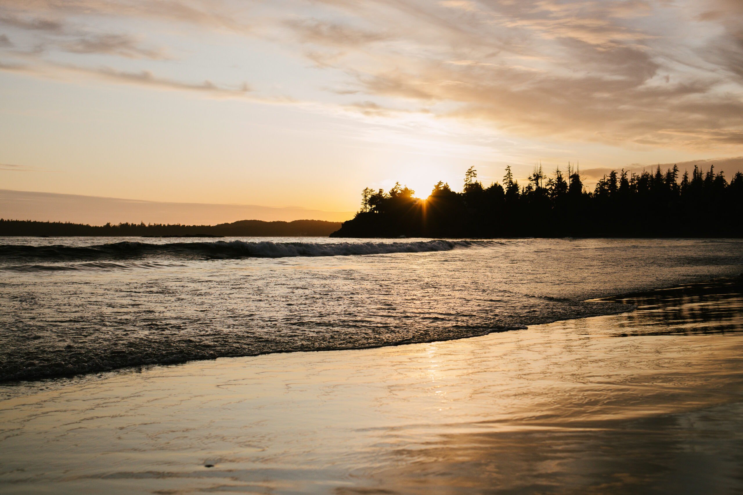
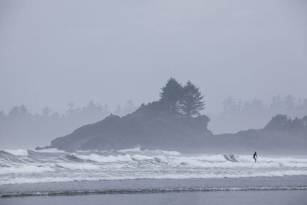
yaaqsis (pronounced yaaq-sis) meaning “Long Beach”
yaaqsis has c̓aqaa (never-ending waves) and distinctive rock formations offshore with strong centrifugal currents and sunset silhouettes inspiring wonder.
c̓ašiiwa (pronounced tsa-shii-wa) meaning the voice of the ocean, aka “Incinerator Rock”
“c̓ašiiwa,” Gisele pronounces tsa-shii-waa aloud. “It’s the name to me, when I translate it, sounds like the voice of the ocean, or ocean speaks.”
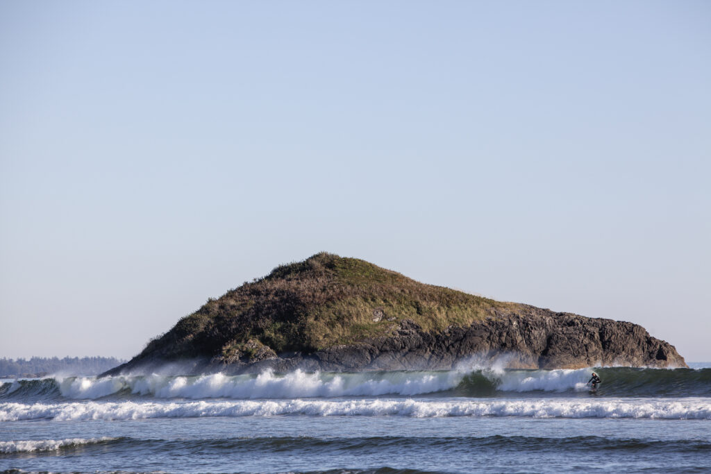
čaw̓inʔis (pronounced cha-win-is) meaning island on the beach, aka “Lovekin Rock”
“That also is an important place, one which we admire from afar,” shares Gisele. “It’s said to be the heart of a supernatural being with the waves always beating against it. It’s also the site where a Chinese vessel arrived and sank a few hundred years prior to when Europeans began travelling this coast.”
muuyapił (pronounced muu-ya-pilth), meaning the fourth rock, aka “Green Point”
These rocky headlands mark the halfway point on the 16-km beach within the Indigenous co-managed Pacific Rim National Park Reserve stretching all the way to the end of kwisitis (Wickaninnish) Beach.
Always plan ahead by checking the tide forecast and trail conditions.
To learn more:
Visit Klahowya! A multimedia Story Map of Tla-o-qui-aht Place Names: https://storymaps.arcgis.com/stories/bb32db98f93b42babe7627a24b96941a
Native Land Digital app collaboratively maps Indigenous territories, treaties, and languages internationally: https://native-land.ca/
Indigenous BC Trip Planner App includes a map of First Peoples across the province: https://www.indigenousbc.com/explore/map/