
September 5, 2023
Low Tide and the Living Classroom
by Erin Linn McMullan
You don’t have to wait for a blue moon or a supermoon to explore the world of wonders revealed at low tide on Tin̓uwis (aka MacKenzie Beach). The ocean-swept sand stretches out and wraps itself around the rocky headlands, and at zero and negative tides, an isthmus forms a narrow bridge to connect to the small grouping of offshore rocks directly across from the resort. Whether it’s cloaked in morning mist or moonlight, this is a magical place to visit.
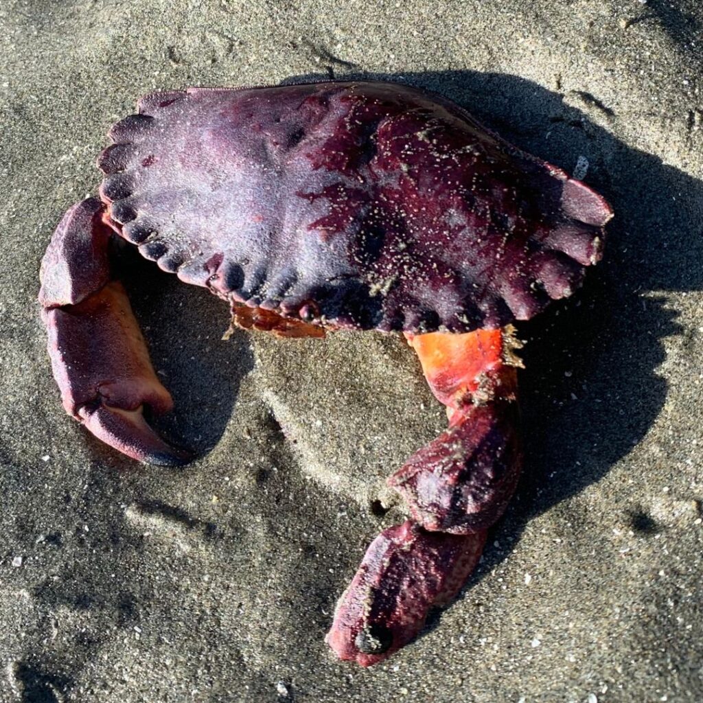

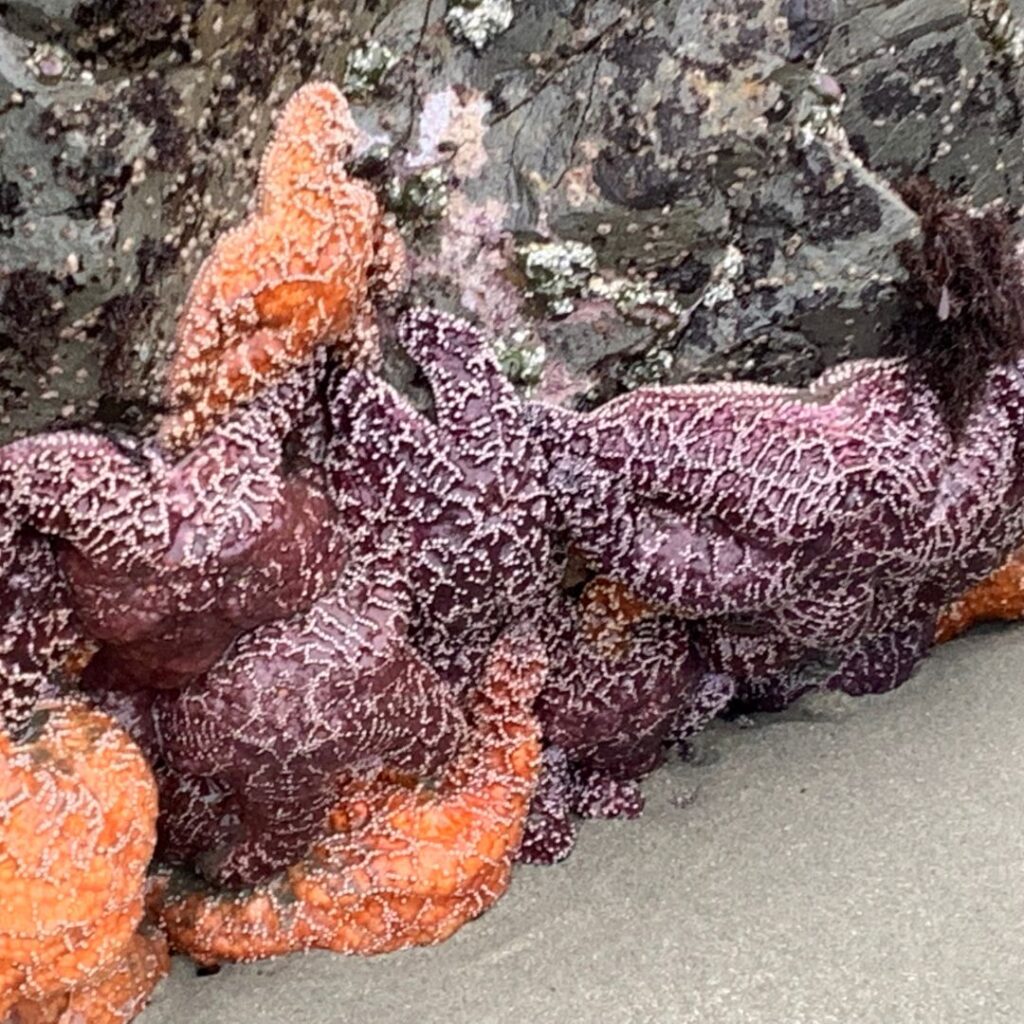
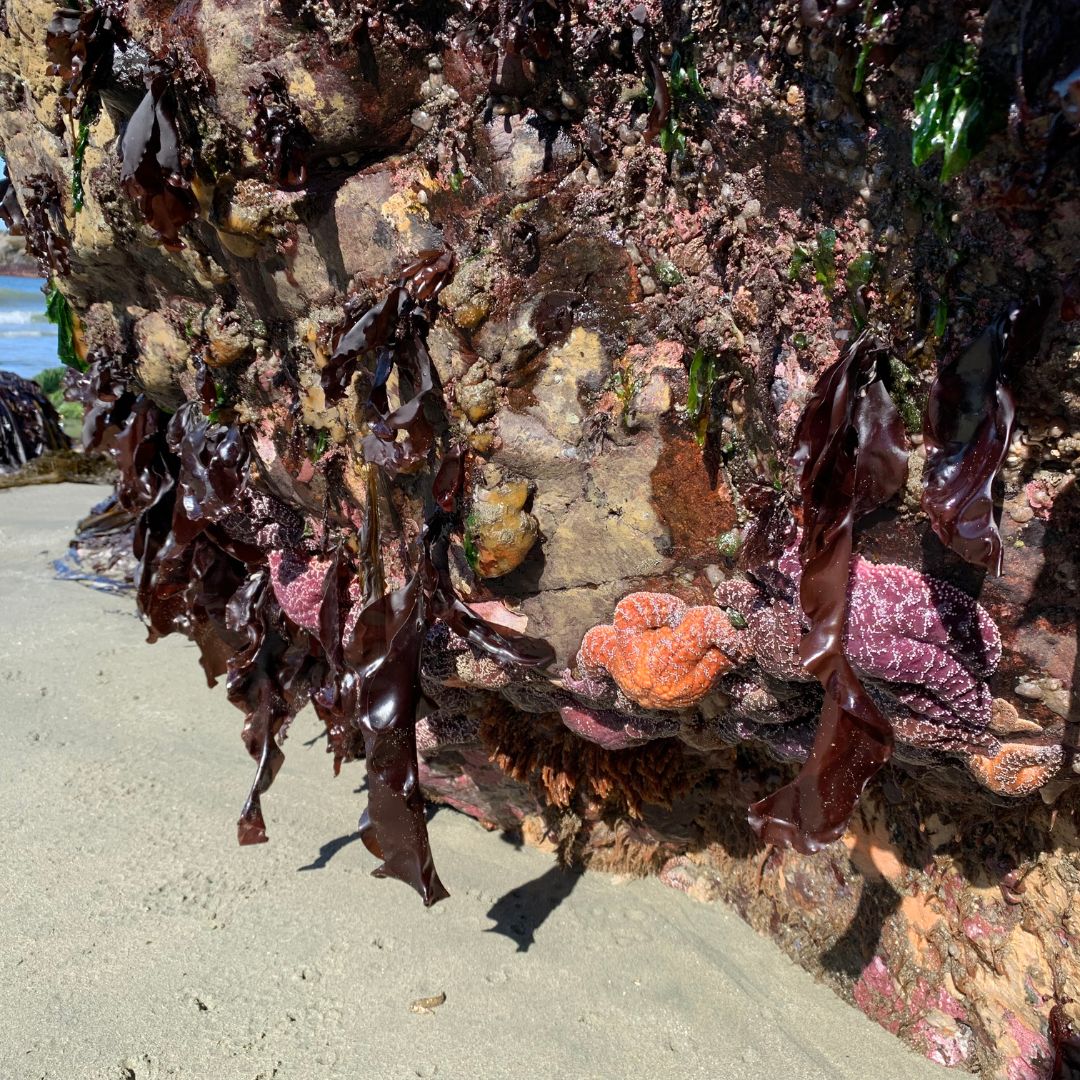
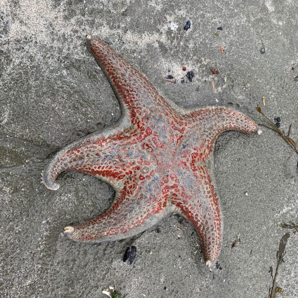
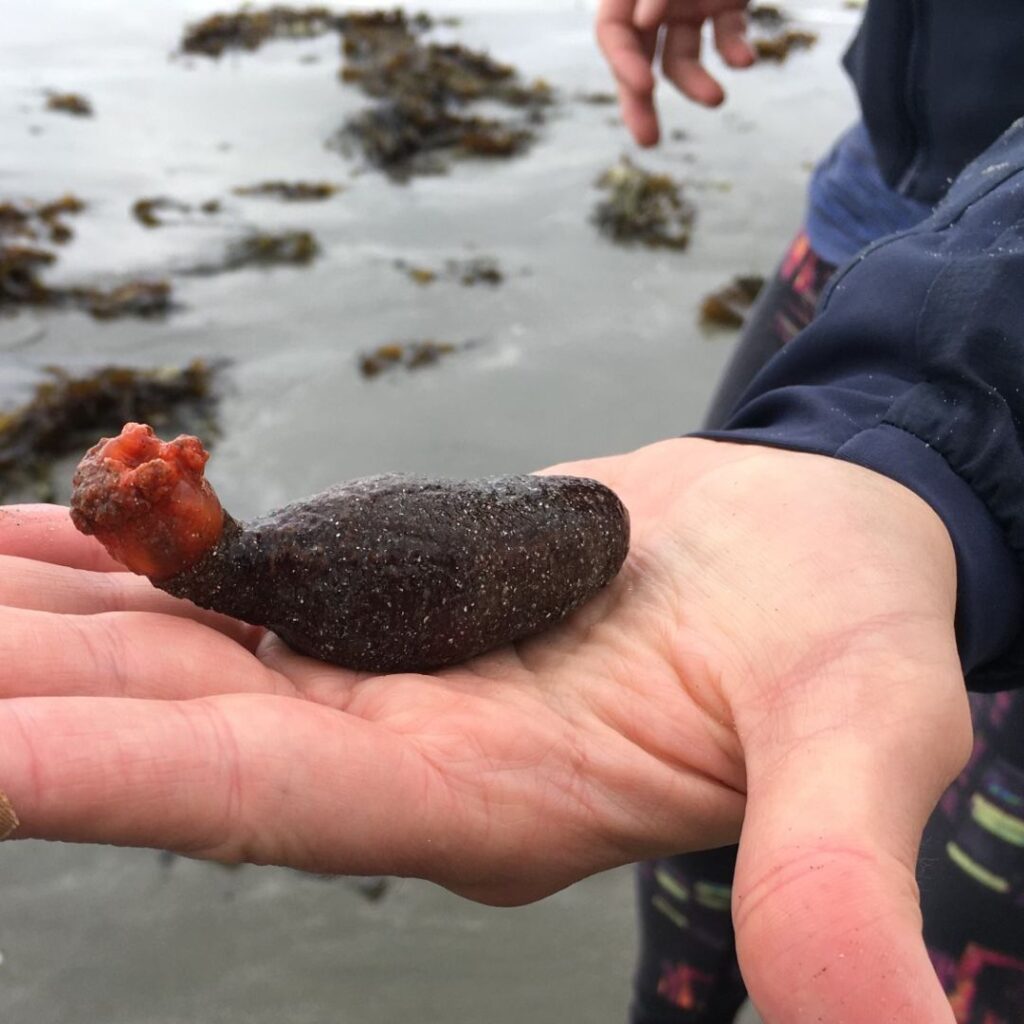
This intertidal zone has so much to teach us and within every tidal pool is a living classroom, filled with marine life from miniature crabs to blossoming green sea anemone to sea stars clinging in colourful constellations. An entire microcosm exists in each single pool.
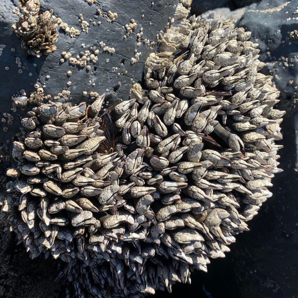
Favourite family haunts include the tidal pools exposed at the foot of “Mushroom Island” and in Crystal Cove with its shallow wading pools and barnacle colonies clustering on rocky headlands.
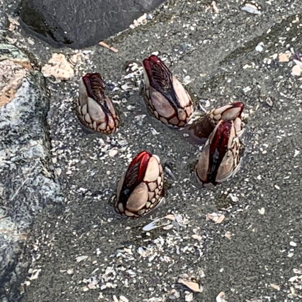
Be careful where you step in Crystal Cove where you may spot the bright red Nakwakta goose-neck barnacles poking their heads up from the sand.
Did you know that barnacles are crustaceans like crabs and lobsters (but without gills) and that they stand on their heads to feed? Or that the giant acorn barnacle can survive both for long periods out of water and up to 90 metres underwater? One variety of acorn barnacle, Cryptolepas rhachianecti, sometimes called the “gray whale barnacle”, hitchhikes on the whale during migration to improve its chances for food.
Northern striped dogwinkle, colourfully shelled snails from the mollusc family can also be found in groups on semi-protected and exposed rocky headlands. See if you can spot a bright yellow spindle-shaped shell, then scan the area for similar shells in white, black or brown.

Chitons (pronounced ky-ton) are another mollusc with eight shells or plates and a girdle of muscle designed to help withstand heavy waves in the intertidal zone and considered a living fossil whose design has not changed significantly over 300 million years. There over 1,000 varieties, including the Chocolate Chiton which has been spotted locally.

Let curiosity reign as you launch a scavenger hunt to engage children in active learning, hours of observation, and fun. Start with an easy-to-find Eccentric sand dollar and then give them an open-ended directive like, “What’s the weirdest thing that you can find?”
If you need help identifying marine life, including over 40 species of sea stars, as well as over 40 species of shorebirds, who live or migrate through here, you can download free apps like iNaturalist™ and SmartBird™ to your phone. Or consult these parent-recommended beachcombing books available at the local bookstore or library: Marine Life of the Pacific Northwest Coast: A Photographic Encyclopedia of Invertebrates, Seaweeds and Selected Fishes and Whelks to Whales: Coastal Marine Life of the Pacific Northwest.
Don’t forget to scan the surf for river otters, porpoises, and seals (Stellar, California, and occasionally, Elephant seals), and the horizon for whales (Humpbacks, Pacific gray whales, and Orcas) passing through the channel beyond this protected intertidal beach.
Imagine too the hidden worlds you may only catch a glimpse of from watery pocket-caves where octopi are sequestered, to mini-geysers erupting from the sand where geoducks dig in, to Etch-A-Sketch patterns traced across its smooth surface by burrowing blood worms below.
In spring and summer, you may spot a flotilla of tiny blue sailboat-like creatures washed ashore. Velella Velella – By the Wind Sailor – is a hydrozoan related to jellyfish and an entire colony of tiny polyps lives beneath the raft and sail-like fin that helps propel them across great distances in the ocean.
During negative tides (less than 0 m) in summer, you may even be able to reach the sand spit that forms on Ḥiłwinʔis, (pronounced Hilth-win-is) aka Middle Beach by following a thin band of sand around the rocky headlands. (Plan to get your feet wet!) At the far end of this beach, you’ll discover the super-city of barnacle colonies clinging to the headlands and surprisingly deep tidal pools atop it. When you’re exploring, always pay attention to the ever-changing tides and use the high tide trail to get safely back.
Tofino, traditionally known as Načiks (pronounced Na-chiks), located on the west coast of Vancouver Island in the Pacific Northwest, experiences mixed semi-diurnal tides. This means that (generally) there are two tidal cycles per day with two lows and two highs of different lengths.
To help plan your low tide forays, you can pick up the Tofino Tide Guide at the reception desk at Tin Wis Resort or quickly consult an online resource like tide-forecast.com.
Remember to practice ʔiisaak, which is often translated as meaning “respect” but it’s also a verb: to be observant, to appreciate, AND to act accordingly.[1] Give the right of way and plenty of space if you encounter foraging wildlife. Leave no trace – take only photos and no souvenirs. That tiny shell may provide important housing for marine life.


Please share your photos of your low tide treasures on social media by using the hashtags #lowtidetinwis and #lowtidetofino.
Practice a 5-minute beach clean-up if you find microplastics or other waste washed ashore. This can be a great teachable moment for children and help begin habits to last a lifetime.
Tin Wis is the ancestral home of Tla-o-qui-aht and has been stewarded by the people since time immemorial. To learn more about its history, please read, “Rough seas calming: Tin Wis, past, present, and future: https://tinwis.ca/rough-seas-calming-tin-wis-past-present-and-future/
Other recommended low and negative tide destinations within Tla-o-qui-aht Tribal Parks and in Yuułuʔiłʔatḥ traditional territory:
· The tombolo (sandbar) that forms between North and South Chesterman Beaches and C̓ixwatsac (pronounced Tsix-wat-sats) aka Frank Island. [suggested link to word tombolo which features Frank Island: https://canadiangeographic.ca/articles/geography-word-of-the-week-tombolo/]
· During summer, Rosie Bay with its caves and tidal pools is accessible at low tide from South Chesterman. At extreme low tides, you may even reach Pettinger Point and connect via the trail to Č ̓aḥayis (pronounced Cha-ha-yis) aka Cox Bay. You can return via the MUP.
· During negative tides, ƛaakašiis (pronounced Tlaa-ka-shiis) aka Tonquin Beach expands below the trail’s overlook to connect with Second and Third Beach where you can reconnect to its rainforest trail.
· qaanimč̓a aka Florencia Bay in Ucluelet, BC in the co-managed Pacific Rim National Park Reserve where a virtual moonscape of subtidal rocks is revealed at low tide.
To learn more about Tla-o-qui-aht traditional place names please visit this local storymap: https://storymaps.arcgis.com/stories/bb32db98f93b42babe7627a24b96941a
[1] Gisele Maria Martin, “Rough Seas Calming: Tin Wis, past, present, and future”: https://tinwis.ca/rough-seas-calming-tin-wis-past-present-and-future/
Thanks to Lana, Brian, Annika, and Chloe for all the low tide adventures!